The Haunting of El Tovar: A Grand Canyon Mystery

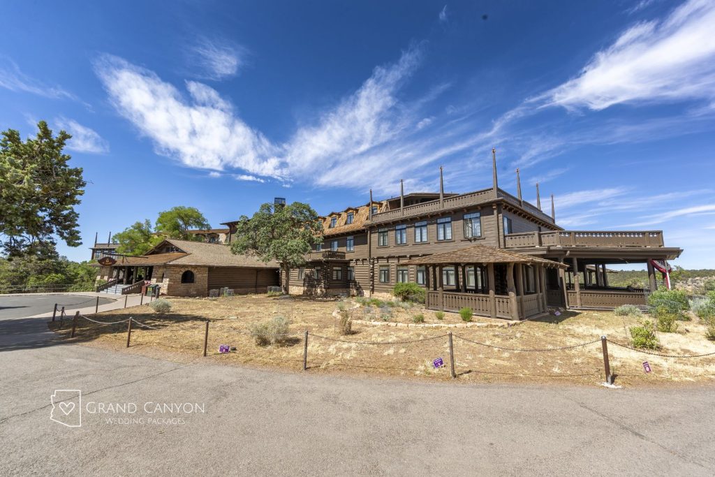
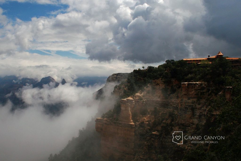
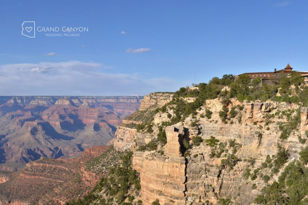
El Tovar Landscape View perched on the South Rim of the Grand Canyon

Not every Grand Canyon story involves geology, hiking trails, or mule rides. Some center around unexplained footsteps, shadowy figures, and guests who swear they experienced something unusual inside the El Tovar Hotel. True or not, the stories have become part of the experience for curious visitors.

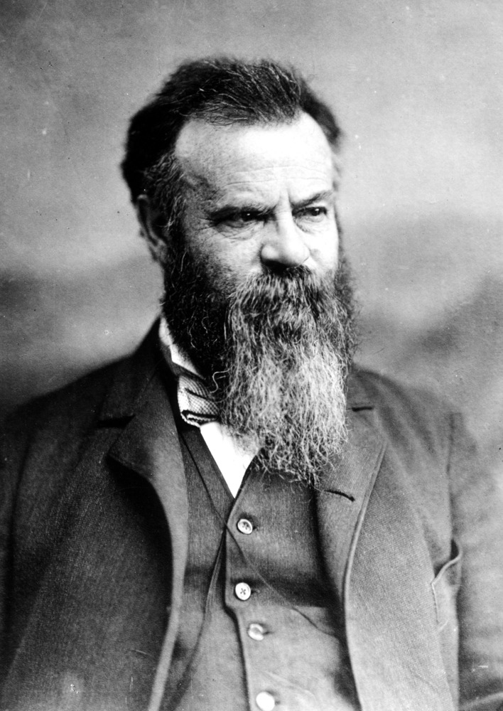
In fact, one of the most common ghost sightings at the El Tovar involves the man who was a hospitality pioneer. Harvey lived to see his dream of bringing refined hospitality to the rugged Southwest become a reality, but he didn’t live to see the famous Grand Canyon hotel open. That is, some say, until after his death.

Does the ghost of Fred Harvey still walk the rustic hallways, peeking out at those stunning Grand Canyon views? What other guests checked out but never really left? For couples intrigued by the paranormal possibilities, the El Tovar should be part of your Grand Canyon wedding or elopement.


The History of El Tovar

Opened in 1905, the El Tovar Hotel was designed to turn the Grand Canyon from a rugged frontier destination into one of America’s great luxury travel experiences.

Built by the Santa Fe Railway along the South Rim, the hotel gave train passengers a level of comfort that was rare in the remote Southwest at the time. Architect Charles Whittlesey blended rustic and European-inspired design elements, creating a lodge that felt both elegant and connected to the surrounding landscape.

The hotel quickly became a destination in its own right. Presidents, celebrities, scientists, and adventurers all passed through its doors as Grand Canyon tourism exploded in the early 20th century.

The Fred Harvey Company operated the property and helped establish the service standards that made the hotel famous.

More than a century later, the El Tovar remains one of the most iconic and historic lodges in the National Park System. It’s also the longest-operating hotel at the Grand Canyon.
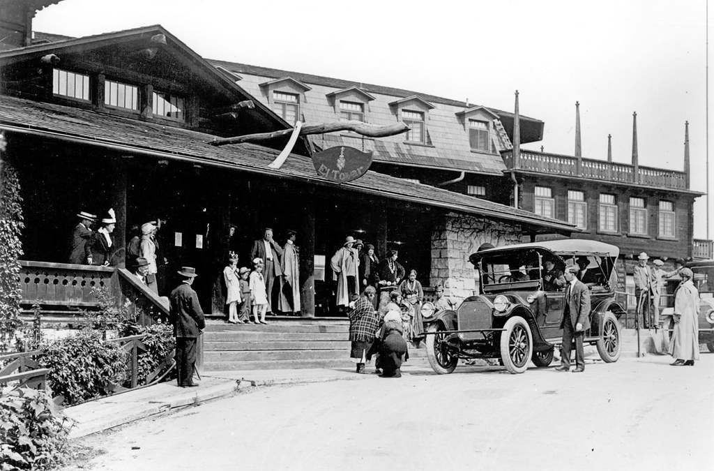
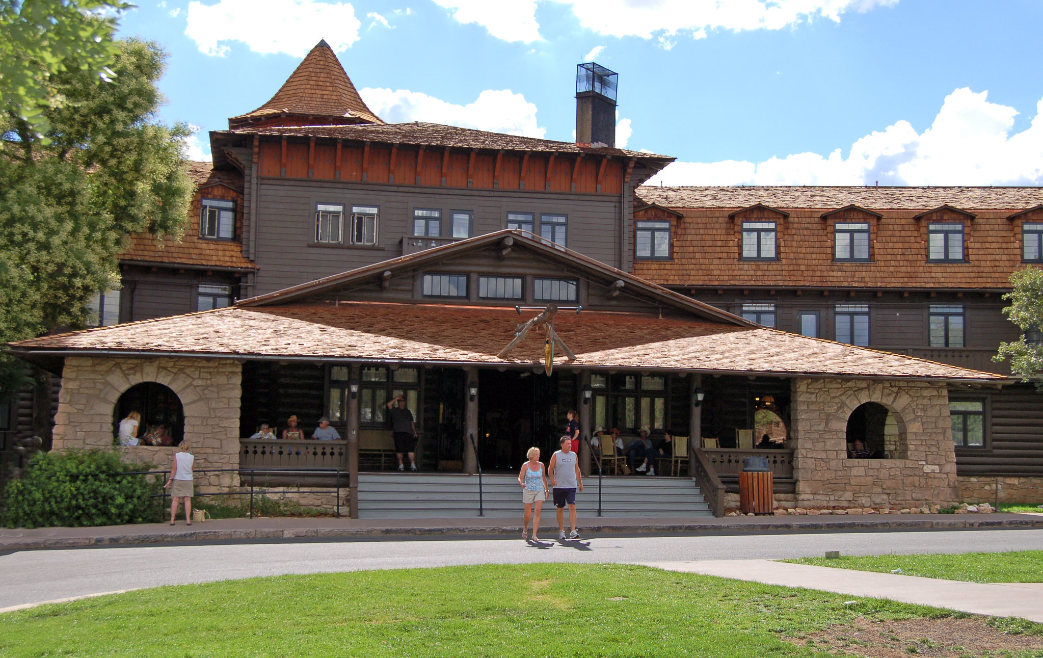
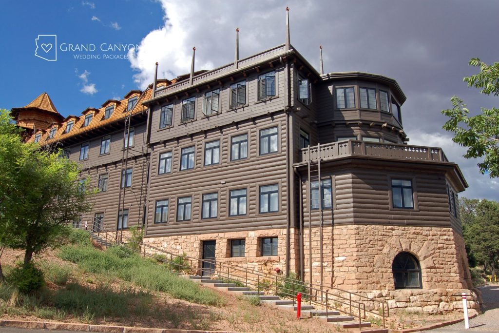
El Tovar Hotel: Then & Now

Who Was Fred Harvey?

Born in England in 1835, Fred Harvey immigrated to the United States as a teenager and eventually transformed travel in the American West.

At a time when railroad travel was less than ideal for tourism, without much to do once a visitor arrived, Harvey stepped in.

Harvey built a reputation around clean hotels, quality meals, professional service, and consistency.

Through his partnership with the Santa Fe Railway, the Fred Harvey Company helped create an entirely new kind of tourism experience across the Southwest.

The Grand Canyon became one of the crown jewels of that vision. Harvey’s company operated the El Tovar Hotel and later helped shape much of the South Rim experience visitors still recognize today. That includes historic lodges, gift shops, tours, and architecture tied to designer Mary Colter.

Although the original Fred Harvey Company changed ownership decades later, its legacy still lives on through Xanterra Travel Collection, which operates several Grand Canyon and other national park lodging and tourism experiences today.

In many ways, the modern Grand Canyon vacation experience still follows the blueprint Harvey helped create more than a century ago. Fred Harvey was 65 years old when he died in 1901, four years before the El Tovar Hotel opened in 1905.

The timing of his death makes the ghost sightings at the El Tovar that much more intriguing.


Ghost Sightings at the El Tovar Hotel

Whether you find ghost stories fascinating or forboding, there’s a lot of suspicious activity reported by guests and hotel workers over the years.

Fred Harvey Is Waiting

Fred Harvey is nothing if not a “friendly” ghost. Anecdotal reports claim a well-dressed (yet in early 1900s attire) and polite man wanders the hallways. He’s been known to encourage guests to attend a “holiday party,” even in the middle of summer.

Cori-Ann was a housekeeper in the 1980s. She wrote on Facebook, “He slamed a door on me once, when I was a maid there and cleaning rooms on the first floor. I said, ‘Knock it off, Fred.’ And, he did.”

Other Ghosts of the El Tovar

Other reports include ghostly figured appearing in TV sets, mirrors, or windows. Apparently, some of the ghosts like to mess with guests while they rest in their rooms.

Christopher wrote on TripAdvisor, “I’ll be honest, I’m not a believer in ghosts. And even after our experience, I still believe there must be a logically explanation. My wife and I were sitting in our room, and the corner floor lamp turned on and off. This switch turned three times on its own. We heard the hotel was haunted before we stayed there . . . so maybe we did experience something.”

In another instance, Mark writes, “About 1am, my wife was awakened by someone running their finger across her lips. She shrugged it off and went back to sleep. A short time later, someone grabbed the toe of her foot that was sticking out of the covers. She felt a presence of someone standing next to her. She could not move for some time out of fear.”

Even a response from Xanterra on one of the reviews added, “We do hear stories similar to yours, so there may be something to the haunted rumors.”

“I said, please ghost, let me in, so I can just go to bed. Then the door opened, no problem! This happened three times!”

In any event, the ghosts seem keen to accommodate travelers’ requests. Kathelln on TripAdvisor: “I did wonder if my room on the lower level was haunted because the door seemed to unlatch when I used the key, but it felt like something was preventing the door from opening until I said, please ghost, let me in, so I can just go to bed. Then the door opened, no problem! This happened three times!”

El Tovar Grand Canyon

Ghost Tours in Northern Arizona

The ghost stories aren’t reserved for the South Rim of the Grand Canyon. Reports of shadowy figures near Phantom Ranch at the bottom of the canyon, lights hovering near the plane crash site in “Crash Canyon,” and a “Wailing Woman” walking the Transept Trail on the North Rim looking for her lost family. Read more about them in the Ghosts of the Grand Canyon book.

While there aren’t official paranormal tours in the Grand Canyon National Park, nearby Flagstaff offers up paranormal possibilities.


Plan an El Tovar Wedding With a Side of Grand Canyon Lore

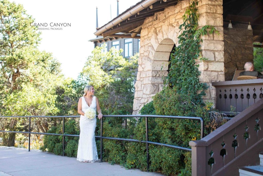
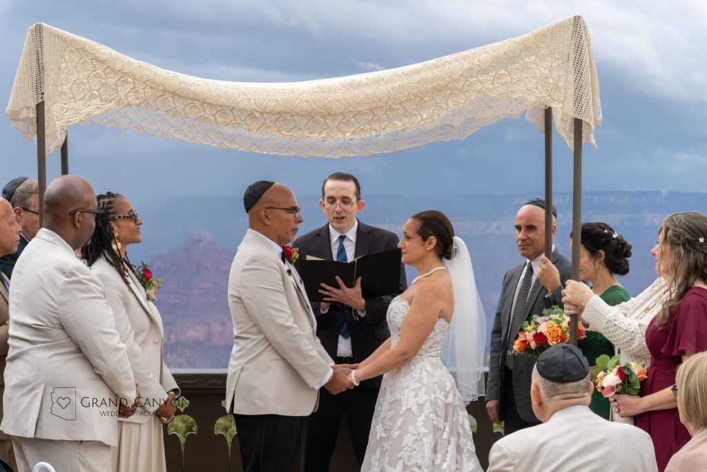
Whether you believe in ghosts or not, there’s just something timeless yet priceless about the El Tovar. If you want to include this location as part of your Grand Canyon wedding, elopement, or special event, we can help. We can even work in ride on the Grand Canyon Railway as part of the experience. Plus, the El Tovar Hotel is one of the several lodging recommendations near the top viewpoints for Grand Canyon South Rim ceremonies.

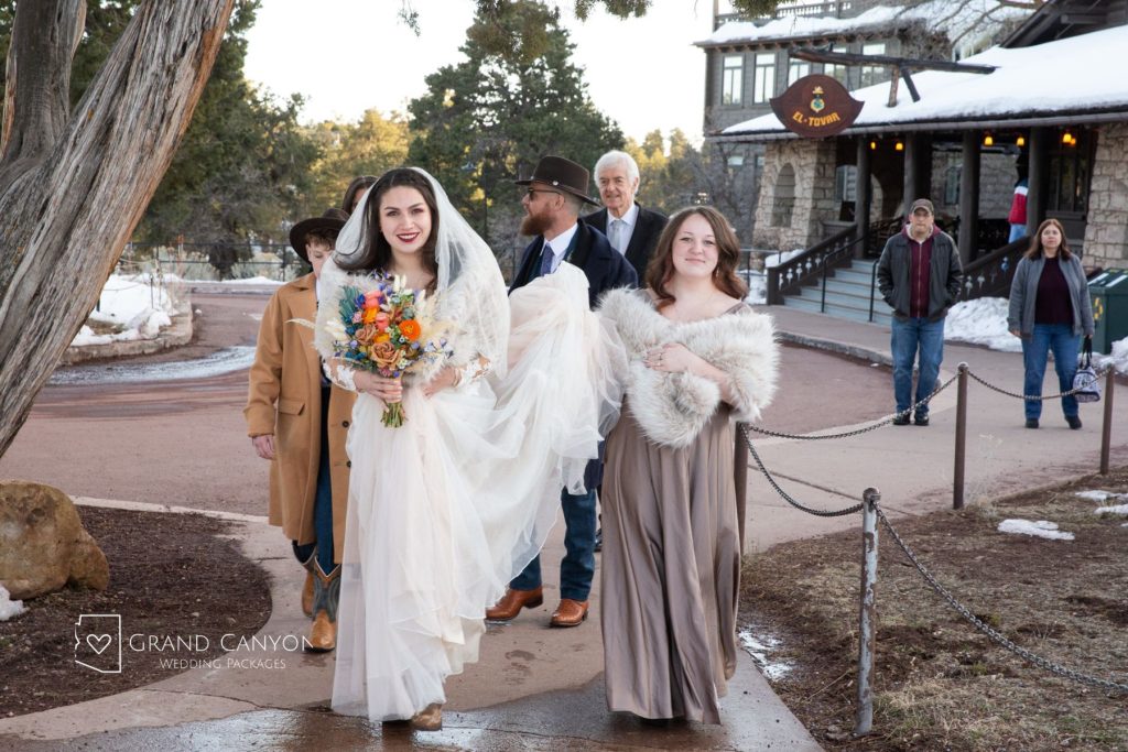
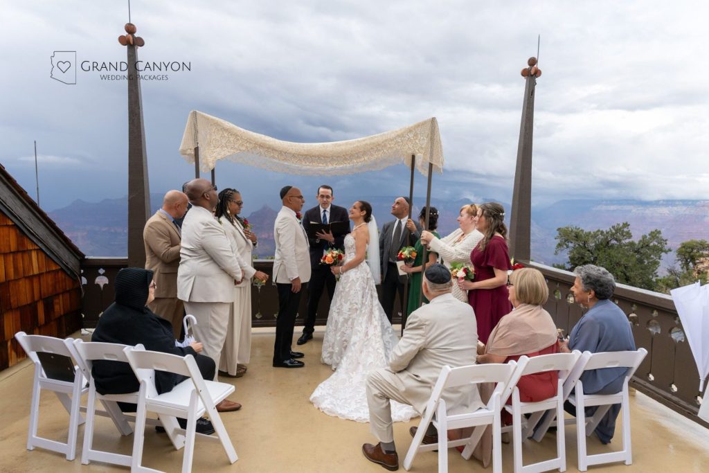
Check out the slideshow below to see some of the stunning photos of weddings we’ve hosted at the El Tovar. Then reach out to us to start planning today.

  • El Tovar Grand Canyon
  • El Tovar Grand Canyon
  • El Tovar Grand Canyon
  • El Tovar Grand Canyon
  • El Tovar Grand Canyon
  • El Tovar Grand Canyon
  • El Tovar Grand Canyon
  • El Tovar Grand Canyon
  • El Tovar Grand Canyon
  • El Tovar Grand Canyon

Best Space Travel Attractions Near the Grand Canyon for Couples and Wedding Guests

Panorama of Crater in Cinder Hills OHV Area

With the NASA Artemis program reigniting excitement about returning humans to the moon, America has once again become fascinated with space travel. What many travelers don’t realize is that part of that story runs straight through Northern Arizona. These space travel attractions can be part of your Grand Canyon wedding travel plans.

While Houston and Kennedy Space Center in Florida get a lot of the bragging rights, Flagstaff and the surrounding area helped get boots on the lunar ground. The landscapes here, beyond the Grand Canyon, are about as close to the moon as you’ll find on Earth.


Top 4 Space Travel Attractions in Northern Arizona

From volcanic terrain near Flagstaff to meteor impact sites and world-famous observatories, this region quietly became one of the most important places in America’s space exploration history.

In fact, all of the 24 men who walked on the moon first walked through the landscape around Flagstaff as part of their training. If you’re looking for an out-of-this-world adventure during your Grand Canyon wedding trip, or want to share this with your wedding guests, we’ve rounded up the top five sites every space travel fan needs to see.

USGS Astrogeology Science Center

"Grover" the rover that USGS built to train the Apollo astronauts before their trips to the Moon is on display in the lobby of the USGS Astrogeology Science Center in Flagstaff.
“Grover,” the rover that USGS built to train the Apollo astronauts before their trips to the Moon, is on display in the lobby of the USGS Astrogeology Science Center in Flagstaff.

Long before astronauts stepped onto the Moon, scientists in Flagstaff were helping map it. The USGS Astrogeology Science Center became a key hub for Apollo-era astronaut training, planetary mapping, and space exploration research.

Today, visitors can explore the same facility where lunar and Mars mission science still happens, making it one of Northern Arizona’s most underrated stops for space fans. This isn’t your traditional walk-in space travel attraction, but reservations are easy to make by emailing the center, and better yet, it’s free!

Things to see include:

  • The famous Grover lunar rover that trained the astronauts on Earth
  • Explore Moon and Mars maps used in real mission planning
  • Walk the topographic floor map of Mars and Arizona’s unique landscapes
  • Learn how scientists map planets without ever setting foot on them
  • Dive into exhibits about asteroids, impact craters, and robotic exploration

Out-of-This-World Fact: One of the founders of the USGS Astrogeology Science Center, planetary scientist Eugene Shoemaker, became the first person to have their ashes placed on the Moon after NASA carried them aboard the Lunar Prospector mission in 1999.


Lowell Observatory

Lowell Observatory Rotunda Museum

Perched above Flagstaff, Lowell Observatory helped shape modern astronomy long before the Space Race began. Founded in 1894, the observatory is famous for the discovery of Pluto and for decades of planetary research that later supported NASA-era exploration.

Today, Lowell Observatory remains one of the best space attractions in Northern Arizona thanks to its mix of historic telescopes, hands-on exhibits, live science programming, and some of the clearest dark sky viewing in the country.

Visitors can look through telescopes, explore interactive space exhibits, learn about planets and galaxies, and experience the same high-elevation skies that made Flagstaff a global astronomy hub in the first place.

General admission tickets start at $35 for adults, $20 for kids 6-17 years old, and $30 for those 55+. However, check the menu for a list of add-on experiences.

Weddings at Lowell Observatory

Lowell Observatory offers more than a tourist attraction; it’s also a wedding venue. Contact Grand Canyon Wedding Packages to learn more about having a wedding, elopement, or special event at Lowell Observatory.

  • Lowell Observatory wedding
  • Lowell Observatory wedding
  • Lowell Observatory wedding
  • Lowell Observatory wedding
  • Lowell Observatory wedding

Cinder Lakes Apollo Training Area

Cinder Lakes Apollo Training Area in Coconino National Forest

Just off Forest Service Road 776 in Flagstaff, one small step takes a giant leap into Apollo astronaut training.

The Cinder Lake Crater Field was created in 1967 when the United States Geological Survey and NASA used explosives to transform volcanic terrain into a simulated lunar surface. After new Moon images revealed a heavily cratered landscape, Apollo astronauts needed a realistic place to practice navigation, geology, and sample collection before heading into space.

Today, the site still looks surprisingly lunar, with hundreds of artificial craters scattered across black volcanic cinders south of Sunset Crater Volcano National Monument. It remains one of the most fascinating hidden space history sites in Northern Arizona.

Want to ride as the astronauts did? A modern-day experience could include the nearby Cinder Hills Off-Highway Vehicle Area.

Meteor Crater

Meteor Crater in Winslow Arizona, one of the space travel attractions in Northern Arizona

About 40 minutes east of Flagstaff in Winslow, Meteor Crater looks like something pulled straight from a sci-fi movie set.

The crater formed roughly 50,000 years ago when a meteor slammed into Earth at speeds estimated at around 26,000 miles per hour. It stretches nearly a mile wide and more than 550 feet deep. It remains one of the best-preserved meteor impact sites on the planet.

The site also became part of America’s space story. During the Apollo era, NASA astronauts visited Meteor Crater for geology and impact training while preparing for lunar missions. Scientists used the crater to better understand what astronauts might encounter on the Moon. The Apollo 11 Space Training Capsule is on display, and admission to the Discovery Center and Space Museum is included with admission.

WHILE YOU’RE HERE: Winslow is part of the Route 66 “Mother Road.” Stop by to get a photo “Standing on a Corner in Winslow Arizona” and drive the musical highway that plays the song.


Astrotourism in Northern Arizona: Space Travel Attractions and Pristine Night Skies

While those space travel attractions keep you busy during the daytime, don’t give up at night. As the first International Dark Sky City and several Dark Sky Parks in the region, stargazing simply must be part of the itinerary.

When you’re ready to start planning a Grand Canyon elopement, wedding, or special event, we can help. As locals, we know the services, vendors, rules, and tools to make your adventure out of this world.

Sycamore Canyon: Meet Arizona’s Second Grandest Canyon

Sycamore Canyon

Most people know Arizona for one canyon. You know the one. Massive. Iconic. Plastered across calendars, postcards, and social media. The Grand Canyon is iconic, but Arizona has another canyon that quietly slips under the radar. Sycamore Canyon stands as the second largest in the state.

As part of the Sycamore Canyon Wilderness, the smaller sibling of the Grand Canyon cuts through the Northern Arizona landscape. The selling points? Dramatic cliffs, dense forest, seasonal waterfalls, and a level of solitude that feels increasingly rare in the Southwest. It also gives a little “Grand Canyon of the Yellowstone” vibes.

It may not have the fame of the Grand Canyon or Yellowstone National Parks, but honestly, that is one part of the appeal.

Sycamore Canyon
Sycamore Falls | Photo Courtesy: Kaibab National Forest.

Where Is Sycamore Canyon?

Sharing boundaries with Coconino, Prescott, and Kaibab National Forests, Sycamore Canyon Wilderness covers more than 58,000 acres. It sits south of Williams, southwest of Flagstaff, and west of Sedona.

Depending on your selected trail and direction of approach, you’ll want to visit a ranger station before heading into the wilderness.

As the name suggests, this is protected wilderness. That means none of the amenities you might expect at the Grand Canyon. Roads can be rough, mobile connections are rare, and it takes a couple of hours of effort driving to even reach a trailhead.

What awaits you when you get there is pretty grand, even by Grand Canyon standards.

Sycamore Canyon
Photo Courtesy: Kaibab National Forest.

How Big Is Sycamore Canyon?

It’s hard being the smaller sibling to the Grand Canyon in Arizona. Even impressive states for a canyon don’t hold a candle to the grandeur of the grandest. However, Sycamore Canyon also offers a more digestible option to explore when the Grand Canyon seems too intimidating.

FeatureSycamore Canyon WildernessGrand Canyon National Park
Ranking in ArizonaSecond largest canyonLargest canyon
Length20 miles278 miles
Massive national park with global recognition7 miles at widestAbout 10 miles average rim to rim
Depth1,080 feet deepAbout 1 mile deep
Rim Elevation4,680 feet7,000 to 8,000 feet
Lowest Elevation3,600 feet at canyon bottomAbout 2,400 feet at Phantom Ranch
Protected Area Size58,441 acres1,218,275 acres
Overall FeelRemote wilderness with lighter crowdsMassive national park with global recognitio

While Sycamore Canyon is the second biggest canyon in Arizona, it’s worth noting that you could fit 22 Sycamore Canyons into the Grand Canyon.

Sycamore Canyon
Photo Courtesy: Kaibab National Forest.

Notable Features in Sycamore Canyon

Aside from the lack of crowds, other elements worth exploring in Sycamore Canyon stand apart from the Grand Canyon’s magnetism.

Where the Colorado Plateau Meets the Mogollon Rim

Part of what makes Sycamore Canyon so geologically interesting is its location near the edge of the Colorado Plateau and the base of the Mogollon Rim. The canyon cuts through layers of limestone, sandstone, and volcanic rock while connecting higher elevation pine forests with lower desert terrain.

That transition creates a surprisingly diverse landscape with changing ecosystems, dramatic cliffs, and terrain that feels different almost every few miles.

Sycamore Falls

One of the biggest surprises in Sycamore Canyon is that it actually has waterfalls. Sycamore Falls is seasonal, so timing matters. After snowmelt or heavy rain, water spills dramatically over layers of volcanic rock into the canyon below. During dry stretches, it can look more like a cliff than a waterfall.

A Rare Riparian Canyon in Arizona

Parts of Sycamore Canyon support riparian habitat, meaning water helps create pockets of surprisingly lush vegetation. Cottonwoods, sycamores, willows, and shaded creek areas break up the otherwise rugged high desert scenery. The scenery feels far more forested and intimate than the sweeping expanses of the Grand Canyon.

Sycamore Creek

We know the Colorado River carved the Grand Canyon. As part of that Colorado River watershed, Sycamore Creek helped shape this canyon landscape. Depending on the season, it may flow steadily, form pools, or nearly disappear in spots. The creek corridor attracts wildlife and adds cooler temperatures in some lower canyon areas.

Sycamore Canyon
Sycamore Creek in Sycamore Canyon | Photo Courtesy: Kaibab National Forest.

Trails of Sycamore Canyon

Trails in Sycamore Canyon lean more rugged than polished. Some routes follow forested rims with wide canyon views. Others drop deep into creek corridors where conditions can change fast with the weather and water levels.

Sycamore Rim Trail

Length: About 11 miles full loop
Difficulty: Moderate

This is the signature hike of the wilderness area. The trail circles portions of the canyon rim through ponderosa pine forest with frequent overlooks into the canyon below. Most of the elevation changes are manageable compared to inner canyon routes, making it one of the more approachable ways to experience Sycamore Canyon.

Parsons Trail

Length: About 8 miles round trip
Difficulty: Moderate

Parsons Trail follows sections of Sycamore Creek and showcases the greener side of the canyon. Hikers may encounter creek crossings, rocky sections, and shaded riparian habitat. The route is popular in warmer months because parts of the canyon stay cooler than exposed rim trails.

Sycamore Canyon Trail

Length: 2 miles, but connecting trails can expand that to up to 12 miles
Difficulty: Difficult

This trail descends into the canyon itself and offers a more remote wilderness experience. Expect uneven terrain, loose rock, steep grades, and limited services. Conditions can vary greatly after storms or seasonal runoff.

Kelsey Trail

Length: About 6.5 miles one way
Difficulty: Difficult to strenuous

Kelsey Trail drops steeply into the canyon through rocky switchbacks and rugged terrain. It is one of the more physically demanding access routes into lower Sycamore Canyon and is best suited for experienced hikers prepared for elevation changes and exposed sections.

Rim of Sycamore Canyon, the second largest canyon in Arizona
View from the Rim of Sycamore Canyon | Credit: USDA Forest Service, Coconino National Forest

Permits or Costs to Enter Sycamore Canyon Wilderness

One of the nice things about Sycamore Canyon is that there is no general entrance fee to enter the wilderness itself.

That said, some trailheads or nearby recreation sites managed by the Coconino National Forest may require a parking or recreation pass depending on where you start your hike. Certain nearby fee areas in Northern Arizona use the Red Rock Pass system or federal recreation passes.

Backcountry camping may require following wilderness regulations, and larger organized groups or commercial activities can require special permits through the Forest Service.

Before visiting, it is smart to check current conditions, road access, fire restrictions, and trailhead requirements through the official Coconino National Forest website since seasonal closures and rules can change quickly in Arizona wilderness areas.

Kelsey Trail Sycamore Canyon
Kelsey Trail view above Sycamore Canyon | Credit USDA Forest Service, Coconino National Forest.

Sycamore Canyon Scenic Drive

Another way to experience the beauty of Sycamore Canyon Wilderness is from your car. The Sycamore Canyon Scenic Drive does include unpaved forest roads, but in dry conditions, the average passenger vehicle should be able to handle the 23-mile ride.

The National Forest Service gives turn-by-turn directions on its website (detailed below), but it’s best to get a map from a ranger station to help navigate the wilderness.

  • From Flagstaff, drive south 29 miles on US 89A through Sedona to Dry Creek Road (FR 152C).
  • Turn north and proceed along FR 152C for 2 miles to the Vultee Arch road and another 2.5 miles to the intersection with Boynton Canyon Road.
  • FR 152C continues southwest, left onto an unpaved road.
  • In about 4 miles, FR 152C intersects FR 525. From here, you can turn north (right) to the Loy Butte spur or south (left) to continue the drive.
  • In another 4 miles, FR 525 intersects FR 525C (Sycamore Pass spur). This road will take you to the East side of Sycamore Canyon.
  • Continue south 5.5 miles to US 89A and another 5.3 miles on pavement back to Sedona.

The Red Rock Loop Road, which accesses Red Rock Crossing and the Verde River, is located off US 89A about one mile south of Sedona.

Sycamore Canyon waterfall
Sycamore Falls in Sycamore Canyon | Photo Courtesy: Kaibab National Forest.

Is the Sycamore Canyon Visit Worth It?

Absolutely, especially if your idea of Arizona involves more than crowded overlooks and shuttle lines. Sycamore Canyon Wilderness delivers a little bit of everything that makes Northern Arizona special. You get canyon views, forest scenery, creek corridors, volcanic landscapes, and hints of the red rock terrain that draws visitors to Sedona.

If you are planning a Northern Arizona getaway, wedding, elopement, or special event, Grand Canyon Wedding Packages, Flagstaff Wedding Packages, and Sedona Wedding Packages are here to help.

How Many Grand Canyons Are There? National Park vs. Parashant vs. West

Lipan Point Grand Canyon National Park South RIm Weddings and Elopements

With a name like the “Grand Canyon,” you’d think there could only be one. Then you start planning a trip and realize the name gets used for several very different destinations. Grand Canyon West is not the same as Grand Canyon National Park. Grand Canyon-Parashant National Monument is something else entirely.

Add in places like Marble Canyon, Glen Canyon, and overlooks or attractions that borrow the Grand Canyon name, and things can get confusing quickly.

The reality is that “Grand Canyon” is often used as both a specific national park and a broader regional label. Some areas are managed by the National Park Service. Others are on Tribal lands or protected monuments.

This identity confuses some people trying to plan a Grand Canyon wedding, elopement, or special event. Let’s clear that up.

Rim Worship Site at Grand Canyon with Grand Canyon Wedding Packages

The Geological Footprint of the Grand Canyon

Long before maps, park borders, or tourism campaigns existed, the Grand Canyon was part of a massive geological story unfolding across the Colorado Plateau.

The canyon system carved by the Colorado River generally begins in Marble Canyon near Lees Ferry in northern Arizona. The landscape transitions from narrower canyon walls into the immense chasm most people associate with the Grand Canyon today.

From there, the canyon stretches westward for hundreds of miles, cutting through layers of ancient rock to Black Canyon. It eventually eases toward the basin that now feeds into the Lake Mead region.

How the Grand Canyon Is Divided Today

This is where planning a Grand Canyon wedding or elopement gets tricky, because many locations offer some type of special event access.

However, the iconic views you see from Grand Canyon Wedding Packages only come from one of the many locations with “Grand Canyon” in the name. It’s also the place most people think of when the Grand Canyon comes to mind.

There are three names most associated with the Grand Canyon:

  • Grand Canyon National Park
  • Grand Canyon West
  • Grand Canyon-Parashant National Monument

Map of Grand Canyon

This map shows the different locations of Grand Canyon National Park, Grand Canyon West, and Grand Canyon-Parashant National Monument.

4 Grand Canyon Locations in the Grand Canyon Footprint

Now, let’s take a closer look at each of the three locations using the Grand Canyon name to help you with planning your event. The location is important, but also knowing what is or isn’t allowed, and the travel time and difficulty included.

Grand Canyon National Park

This is the Grand Canyon most people picture when they imagine sweeping overlooks, layered canyon walls, and iconic South Rim views. The national park protects a large stretch of the central canyon corridor.

It generally extends from the Marble Canyon region near Lees Ferry westward toward the remote western canyonlands near the Hualapai borderlands.

It is also the most accessible section of the canyon for visitors. Paved highways connect the park to major gateway cities like Las Vegas, Flagstaff, and Phoenix. Reaching the South Rim doesn’t require off-road vehicles or backcountry travel experience.

Unlike many protected national park areas, weddings and elopements are allowed at select designated viewpoints and ceremony sites through a permit process managed by the National Park Service.

Those include:

Grand Canyon Village anchors the South Rim, along with a historic district, lodging, visitor’s center, and shuttle hub. Weddings are not allowed below the rim.

TRAVEL TIP: Grand Canyon National Park’s South Rim is 280 miles, about 4:30 drive time, from Las Vegas. From Phoenix, it’s 225 miles and about 3:45 drive time.

If you’re in Las Vegas and you see Grand Canyon wedding opportunities that seem close to the city, that’s Grand Canyon West.

Lipan Point Grand Canyon National Park South RIm Weddings and Elopements

Grand Canyon West (Hualapai Indian Reservation)

Grand Canyon West sits on the reservation lands of the Hualapai Tribe along the western edge of the canyon. The Hualapai Reservation was formally established in 1883. However, the Hualapai people lived throughout this region long before modern borders existed.

This is Tribal land, not part of Grand Canyon National Park. The area is managed by the tribe instead of the National Park Service. That means different rules, different attractions, and separate entrance fees.

The area became world famous after the opening of the Grand Canyon Skywalk in 2007. The glass bridge extends over the canyon rim and lets visitors look straight down into the canyon below.

Grand Canyon West is also known for helicopter tours, cultural experiences, and viewpoints along the western canyon corridor. Compared to the national park, it is much closer to Las Vegas.

If you see Grand Canyon wedding experiences that allow you to land via helicopter on the Canyon bottom, that’s Grand Canyon West. The activity isn’t allowed in Grand Canyon National Park.

Grand Canyon-Parashant National Monument

Sitting on more than one million acres, Grand Canyon-Parashant National Monument protects a huge and remote section of canyon country west of Grand Canyon National Park. The National Park Service and Bureau of Land Management co-manage this landscape.

Logistics and landscape make this a challenging place to plan a wedding or elopement. First, the co-management means that the location of the wedding would require a specific permit from an individual agency or both.

Second, the landscape is beautiful but brutal. This is not the polished, easy-access version of the canyon most visitors imagine. The monument is known for rugged backroads and extreme isolation. No services, power, mobile service, or paved roads are in the monument.

Third, as one of the least-visited public land sites in America, you have no help if things go sideways. Consider Grand Canyon-Parashant as an option for honeymoons if you’re an adventurous couple skilled in backcountry expeditions and self-survivial skills.

Supai Village | Havasupai Tribe

Deep within a side canyon of the greater Grand Canyon system sits Supai, the main village of the Havasupai Tribe. It sits between Grand Canyon West and Grand Canyon National Park on the south side of the Colorado River.

Today, the reservation is known worldwide for its bright turquoise waterfalls and striking red rock canyon scenery. Reaching Supai requires a hike or horseback ride of about eight miles into the canyon or a helicopter service that operates on a limited schedule. No roads lead directly into the village.

The area is managed entirely by the tribe. Visitors must obtain permits and reservations through the Havasupai Tribe, often months in advance.

Havasu Falls on tribal land outside of Grand Canyon National Park is only accessible by reservation and requires a long hike or helicopter ride.

Planning a Grand Canyon Wedding or Elopement at the National Park

The Grand Canyon is far bigger and more complex than many visitors realize. Some areas are designed for easy sightseeing. Others are remote wilderness. Some are managed by the National Park Service, while others are Tribal lands with their own rules, permits, and traditions.

For most couples, Grand Canyon National Park offers the best balance of iconic scenery, accessibility, and approved ceremony locations. At Grand Canyon Wedding Packages, we can design your ideal wedding, viewpoint, and amenities within the national park.

Of course, the canyon is only part of the story in Northern Arizona. Some couples prefer the pine forests and mountain views near Flagstaff. Others fall in love with the red rocks and desert scenery around Sedona.

We help couples navigate the differences between these destinations and plan an experience that fits their vision, comfort level, and sense of adventure. You can also explore things to do in Northern Arizona as you’re planning your Grand Canyon destination wedding.

The Worst Grand Canyon Review Ever: “Valueless,” “Profitless,” and “Forever Unvisited”

Lipan Point Grand Canyon National Park South RIm Weddings and Elopements

The saying goes that you need to see the forest for the trees. In the case of the Grand Canyon, one of its earliest explorers missed that point entirely. He couldn’t see the value in the Grand Canyon. In fact, long before Google Reviews and Yelp were even a thing, his review went down in history as maybe the absolute worst. At least, it was absolutely wrong.

He used words like “valueless,” deeming it to be “forever unvisited.” Quite ironic, considering that Grand Canyon National Park brings in nearly five million visitors a year and has more than a $1.1 billion economic impact. It’s also the most photographed national park in the country and one of the top destination wedding locations.

Who was this explorer who was so shortsighted that he looked at a natural wonder and wrote “after entering… there is nothing to do but leave”?

Exploring the Grand Canyon: The Early Years

While Indigenous people lived in the canyon lands for time immemorial, it wasn’t until the 1540s that the first European attempts to see the Grand Canyon happened. Reports came back that the Hopi convinced the pioneers that the land was an “impenetrable wasteland” and access to the bottom was impossible.

Fast forward about 230 years. The Mexican-American War was over. While the Grand Canyon as we know it today was technically part of the United States, its location sat in the New Mexico Territory.

The map below, from 1852, shows a rough estimate of what the southwestern section of the United States was believed to look like. With no real expeditions through this region, nobody knew how to fill in the map gaps. Most referred to it as “The Great Unknown.”

That was about to change.

Southwestern United States Map, 1852 |Creator: Joseph Hutchins Colton

The Ives Expedition of 1858

Joseph Christmas Ives led an expedition of the Colorado River in 1858. Funded by the government, the U.S. Army Corps of Engineers’ first lieutenant was up to the task.

He led a river steamer named “Explorer.” His mission was to answer the question “Could the lower Colorado River be used as a transportation route from the Gulf of California into the interior Southwest?”

The crew battled the upstream currents from the Gulf of California to the area near present-day Las Vegas. Aside from some intimidating run-ins with Indigenous tribes, things were going well.

As they approached Black Canyon, where the Hoover Dam now stands, nature took over. The narrow canyon, mixed with powerful currents and a massive sunken rock, caused the Explorer to crash.

Ives wrote, “For a second, the impression was that the canyon had fallen in. The concussion was so violent that the men near the bow were thrown overboard.”

“We were shooting swiftly past the currents, eagerly gazing at the mysterious depths beyond, when the Explorer, with a stunning crash, brought up abruptly and instantaneously against a sunken rock.” — Joseph Christmas Ives, 1858

Ives, not one to let a little steamer crash kill the exploration vibe, took three men in a skiff and went past Black Canyon to Eldorado Canyon. From there, Ives took off by land, hellbent on seeing what the Colorado River did as it carved its way east.

He got as far as Cataract Canyon and Frazier Well, which is still part of the Hualapai Indian Reservation today. You might know this region better as Grand Canyon West.

Black Canyon of the Colorado River before Hoover Dam, where Ives’ steamship Explorer crashed.

The Words Ives Might Regret Today

It was in Frazier Well that Ives penned what we might call a two-start review in today’s terms. Like any good reviewer, he listed pros and cons.

For the positive aspects, he wrote, “The extent and magnitude of the system of canyons is astounding. Fissures so profound that the eye cannot penetrate their depths are separated by walls whose thickness one can almost span, and slender spires that seem to be tottering upon their bases shoot up thousands of feet from the vaults below.”

However, whether it was his frustration guiding his pen or just blunt honesty from a hardy man who couldn’t figure out a way through the river canyon, he noted this famous statement.

“The region is, of course, altogether valueless. It can be approached only from the south, and after entering it there is nothing to do but leave. Ours has been the first, and will doubtless be the last.. to visit this profitless locality. It seems intended by nature that the Colorado river, along the greater portion of its lonely and majestic way, shall be forever unvisited and undisturbed.”

“The region is, of course, altogether valueless. It can be approached only from the south, and after entering it there is nothing to do but leave.”

Again, remember that his mission was only to determine if this could be a transportation route. He wasn’t there trying to create the concept of national parks or log a wonder of the world. His final report gave the go-ahead to use the Colorado River from the Gulf of Colorado to Black Canyon, but not further.

Early artwork tied to the Ives expedition leaned heavily into the canyon’s danger and isolation, presenting it as more terrifying than awe-inspiring.

The Next Review: Five Stars

It took another decade before a one-armed Union Army Major penned the next review of the Grand Canyon. Despite the warnings written by Ives, Major John Wesley Powell did his homework and came up with a new plan.

In the 1830s, it became clear that the Green River in Wyoming and the Colorado River must be connected. Numerous attempts to run the whole river downstream from Wyoming through the “Great Unknown” stopped at modern-day Glen Canyon.

That is, until Major Powell entered the chat. A man as formidable as the Canyon himself, he made the trek at least twice.

His notes summarized it as if it were one trip. He was honest to note that the canyon felt like a “dungeon cell,” and the journey as one of “pain and gloom and terror.”

He also questioned why the Indigenous people lived here. “It is ever a source of wonder to us why these ancient people sought such inaccessible places for their homes,” Powell wrote in 1872, adding, “…they chose to imprison themselves within these canyon walls.”

At one point, as food supplies were running low, he almost gave up and headed to the Mormon settlements north. But that dogged determination that made him a Civil War legend was about to pay off.

His notes summarized the Grand Canyon with a perspective Ives didn’t have, and after seeing sights Ives couldn’t reach.

“The glories and the beauties of form, color, and sound unite in the Grand Canyon… It has infinite variety. Its colors, though many and complex at any instant, change with the ascending and declining sun,” Powell wrote, also stating, “The wonders of the Grand Canyon cannot be adequately represented in symbols of speech, nor by speech itself. The elements that unite to make the Grand Canyon the most sublime spectacle in nature.”

“The wonders of the Grand Canyon cannot be adequately represented in symbols of speech, nor by speech itself.”

As far as future visitors? He saw the potential for those who dared.

“It is a region more difficult to traverse than the Alps or the Himalayas, but if strength and courage are sufficient for the task, a concept of sublimity can be obtained never again to be equaled on the hither side of Paradise,” Powell added.

Translated to today’s language? “The Grand Canyon is harder to travel through than even the Alps or Himalayas, but if you are strong and brave enough to endure the struggle, you will experience a level of beauty and awe unmatched anywhere else on Earth.”

It’s also worth noting that Powell had access to photography. While still in its infancy, the time between Ives exploring the canyon and Powell’s journey was notable in photograph advancement.

FROM JOHN WESLEY POWELL’S 2ND EXPEDITION. “REPAIRING BOATS IN THE FIRST GRANITE GORGE.” GRAND CANYON OF THE COLORADO RIVER. AUGUST 1872.

From “Profitless” to Grand Canyon National Park

For decades afterward, the Grand Canyon remained difficult to reach and nearly impossible to wrap your head around. To many Americans back east, the canyon was still more rumor than reality.

Then came more photography. Early photographers brought dramatic images of the canyon to the public. The canyon stopped being seen as just a geological obstacle and started becoming a national treasure.

Railroads accelerated that shift. When the Atchison, Topeka, and Santa Fe Railway expanded access to Northern Arizona in the late 1800s, visiting the canyon became far more realistic. Hotels appeared along the rim. Tourism followed.

One of the biggest turning points came when Theodore Roosevelt visited in 1903. Unlike Ives, Roosevelt instantly understood the canyon’s value. He famously urged Americans to protect it, saying, “Leave it as it is. You cannot improve upon it.”

That mindset helped push the canyon toward federal protection. The Grand Canyon became a national monument in 1908 and officially became Grand Canyon National Park in 1919.

President Theodore Roosevelt (2nd from left) with Governor of Arizona Territory, Alexander Brodie (3rd from left) at Grand Canyon, May 6, 1903.

Your Grand Canyon Wedding Expedition Starts Here

Thanks to the explorers, photographers, railroad workers, conservationists, and visionaries who helped introduce the Grand Canyon to the world, couples today can experience one of the most extraordinary landscapes on Earth without needing to survive a river expedition to get there.

The National Park Service now allows weddings and elopements at select locations along the canyon’s South Rim, transforming a place once considered a “great unknown” into the backdrop for unforgettable celebrations.

At Grand Canyon Wedding Packages, we help guide that journey. From trusted vendors and photography to timeline planning, location guidance, and permit assistance, we’re your explorers in this fabled landscape.

Grandeur Point Grand Canyon Wedding Packages South Rim

Grand Canyon National Park: Entrances, Exits, and Extra Tips to Plan Your Wedding Trip

Moran Point Grand Canyon Wedding Packages South Rim

If you’ve never been to the South Rim of the Grand Canyon National Park, the scale alone can throw you off a bit. It’s not a quick pull-off with a view. It’s a massive, well-managed national park with its own roads, villages, shuttle systems, and viewpoints spread out along the rims.

That’s where this guide comes in. We’re breaking down how to actually get here, what to expect once you arrive, and how to move around without wasting time or missing the spots that matter.

Whether you’re planning a wedding, elopement, or just trying to picture how it all fits together, this will help you get your bearings before you ever set foot on the South Rim.

Moran Point Grand Canyon Wedding Packages South Rim

Grand Canyon National Park: How to Get There

Whether you plan to fly most of the way or want to drive to the Grand Canyon, there are plenty of transportation options. Grand Canyon Wedding Packages can also help with transportation arrangements if needed.

Driving Distance to the Grand Canyon’s South Rim

Since most people start their Grand Canyon adventure at Grand Canyon Village, the heart of the South Rim, we’ll measure distances to and from there.

Here’s the drive time from popular cities:

  • Flagstaff: 79 Miles | 1:30
  • Phoenix: 228 Miles | 3:30
  • Las Vegas: 279 Miles | 4:20
  • St. George, Utah: 272 Miles | 4:50
  • Albuquerque: 398 Miles | 6:40
  • Los Angeles: 491 Miles | 7:30

Popular Airports for Visiting the Grand Canyon

Most visitors opt to fly into a nearby city and then rent a car to get to the South Rim of the Grand Canyon.

Airports include:

While the Grand Canyon Airport is closest, its use is for tours and charters.

The Entrances to Grand Canyon National Park

Three options exist for getting into Grand Canyon National Park, but there’s one that draws the most traffic.

South Entrance | South Rim

The south entrance is the go-to entrance for most visitors. Traffic counts here generally exceed 1.1 million vehicles a year, with April and May being the busiest. More than 120,000 vehicles pass through in those months.

From the south entrance, you’ll drive about five miles to get to Grand Canyon Village. The drive to the south entrance takes about 1:20 from Flagstaff, covering 75 miles.

Traffic backed up at the Grand Canyon National Park south entrance in July.
View live traffic at the south entrance to Grand Canyon National Park.

East Entrance | South Rim

The east entrance is near Desert View on Desert View Drive. About 280,000 cars use this entrance each year. This comes with easy access to the Desert View Watch Tower and the campground. It sits about 25 miles east of Grand Canyon Village. The East Entrance is also about 82 miles from Flagstaff.

The south entrance station webcam always displays the most current traffic conditions. It offers a great way to see how long the line to enter is at any time of day.

East Entrance Grand Canyon National Park

North Entrance | North Rim

Then there’s the North Rim, which is a good distance away for travelers. While it’s just about 9 miles as the crow flies, the drive is closer to 200 miles. That’s going to take about four and a half to five hours. Only about 90,000 vehicles take this entrance, due to the remote location and seasonal closures.

Hiking between the North Rim and South Rim is called the Rim to Rim hike, known to be anywhere from strenuous to brutal. That all depends on the weather, your fitness level, and preparation steps.

DID YOU KNOW? It’s actually a shorter drive to get to the southern entrance to Zion National Park from the South Rim than to get to the North Rim.

North Rim of Grand Canyon National Park
Grand Canyon National Park: Cape Royal Pine (North Rim). NPS Photo by W. Tyson Joye.

The Grand Canyon National Park South Rim Layout

The South Rim of the Grand Canyon is massive, but as far as navigating it in the national park, the area is more digestible for a visitor. The longest route across the South Rim runs 13 miles, while the gathering of most buildings and popular areas to visit spans three miles.

Grand Canyon Village

The area known as Grand Canyon Village is technically a census-designated place with a population of 1,784 people. The land footprint covers 13. 4 square miles. Within Grand Canyon Village, you’ll find three districts.

  1. Visitor Center/Mather Point: Easternmost part of the Village. Shuttle transit center and ample parking are available.
  2. Market Plaza: About halfway between the other two districts. Home to a post office, market/deli, and the park headquarters.
  3. Village Historic District: Original development area of the Grand Canyon’s South Rim. Railroad, historic lodges, and shops are bunched together here. Westernmost spot in the Village.

The distance between Historic District and Mather Point is about three miles.

Grand Canyon National Park: Kolb Studio Sunset at Grand Canyon Village. NPS Photo by Michael Quinn.

South Rim Trail

The South Rim Trail stands as one of the most popular trails in Grand Canyon National Park. It spans 13 miles from Hermit’s Rest to South Kaibab Trail.

Here’s a quick layout of the trail’s stops from the National Park Service.

Destination (heading west)Distance to Next Point (miles)Water (W)Toilet (T)Notes
South Kaibab Trailhead0.8XXShuttle bus stop
Pipe Creek Vista1.4Shuttle bus stop
Mather Point0.7XClosest overlook to Grand Canyon Visitor Center
Yavapai Point0.7XXGlass observation area with canyon information. Shuttle bus stop
Park Headquarters Junction1.2Trail passes historic buildings, restrooms, and water between here and next point
Village Route Transfer0.7Shuttle bus stop
Trailview Overlook0.7Good views of Bright Angel Trail. Shuttle bus stop
Maricopa Point0.5Shuttle bus stop
Powell Point0.3Closest overlook to the Grand Canyon Visitor Center
Hopi Point0.8XPopular sunset spot. Shuttle bus stop
Mohave Point1.1Shuttle bus stop
The Abyss0.9Shuttle bus stop
Monument Creek Vista1.7Dirt trail ends, becomes 9-foot-wide paved trail. Shuttle bus stop
Pima Point1.1Shuttle bus stop
Hermits Rest—XXSmall gift shop and snack bar. Shuttle bus stop
South Rim Trail Overview Map

The Grand Canyon Shuttle

The shuttle service inside Grand Canyon National Park helps people get around. The rides are free, with seasonal availability. It’s best to review the NPS website shuttle page for the most updated information, as schedules and routes can change.

Keep in mind that the shuttles are designed to get you from point to point. They aren’t a tour guide experience.

During the summer, a shuttle route runs between the South Rim Visitor Center and the community of Tusayan. It’s a seven-mile drive that takes about 25 minutes each way.

South Rim Visitor Center Grand Canyon National Park

The Grand Canyon Railway

You can also get to Grand Canyon Village via the Grand Canyon Railway. The 64-mile train ride takes about 2:15 each way. The departure point is Williams, Arizona, and the arrival point is the Historic District of the Grand Canyon Village.

If you’re interested in making the Grand Canyon Railway part of your wedding event, we offer Grand Canyon Railway Adventure Elopement packages.

Grand Canyon Railway Northern Arizona Adventures
We can help plan an excursion on the Grand Canyon Railway from Williams to the South Rim of the Grand Canyon.

Map of Grand Canyon Entrances, Exits, and Points of Interest

Here’s a map to help you see the lay of the land a little better. We’ve included the entrances on the south and east for the South Rim, as well as the distant (200 miles) entrance to the North Rim.

We’ve included hotels and approved wedding, elopement, and proposal locations as well.

Plan a Wedding, Elopement, Proposal, or Special Event at Grand Canyon National Park

We can help you plan a stress-free and spectacular event at the South Rim of the Grand Canyon. We’ve worked in this region for years and have cultivated a list of preferred vendors and services to make your event unique without added layers of stress. Reach out to us today to start planning.

Why You Can’t Marry Below the Grand Canyon Rim (and What to Do Instead)

Grandeur Point Grand Canyon Wedding Packages South Rim

The idea of saying “I do” at the bottom of the Grand Canyon is hard to beat. But before you start mapping out the hike, there’s a key rule every couple should know. Permits to get married below the rim of the Grand Canyon aren’t an option.

On paper, a below-the-rim wedding sounds like the most unforgettable way to tie the knot. In reality, the National Park has a different approach, and it comes down to safety, access, and preservation.

Moran Point Grand Canyon Wedding Packages South Rim

Above the Rim vs. Below the Rim of the Grand Canyon

Above the rim is where most visitors spend their time, with paved paths, overlooks, and accessible locations along the canyon’s edge. Below the rim begins once you drop into the canyon on trails like Bright Angel or South Kaibab, where conditions are more remote and physically demanding.

While couples or wedding guests might consider a below-the-rim hike as part of the wedding adventure, there isn’t a location below the rim that is part of the approved places for Grand Canyon weddings.

The South Rim of the Grand Canyon includes:

  • Grand Canyon Village and nearby lodges
  • Scenic viewpoints along the Rim Trail
  • Designated wedding ceremony sites
  • Easy access from parking areas and shuttle stops
  • Restaurants, visitor services, and accommodations

Below the Rim includes:

  • Trails like Bright Angel and South Kaibab
  • Phantom Ranch and backcountry campgrounds
  • Remote rest houses and water stops (seasonal)
  • Steep, rugged terrain with limited services
  • The Colorado River

The North Rim sits about 200+ miles by road from the South Rim, making it a completely separate experience with far fewer crowds and a shorter season. It includes:

  • North Rim viewpoints and scenic overlooks
  • Access to trails like North Kaibab
  • A quieter, more remote atmosphere overall

If the thought of not going below the rim feels frustrating, it’s worth noting that only about 1% of the 4.4 million or so visitors to Grand Canyon National Park go below the rim each year.

South Rim vs Below the Rim vs North Rim of the Grand Canyon
Grand Canyon South Rim (L), Below the Rim on the Bridge Angel Trail (C), North Rim of the Grand Canyon (R)

Going to the Distance Below the Grand Canyon South Rim

The numbers surprise a lot of people because it looks so close from the top. From the South Rim to the Colorado River, you’re looking at roughly:

  • Elevation change: about 4,500 to 5,000 feet down
  • Distance:
    • ~7 miles via South Kaibab Trail (shorter, steeper)
    • ~9.5 miles via Bright Angel Trail (longer, more gradual)

And of course, whatever you go down, you have to come back up. That’s why it’s considered a serious hike, not just a scenic walk. Plus, the trails below the rim can be narrow, crowded, and shared with mule rides.

First two miles of bright angel trail on a rim to rim hike at Grand Canyon National Park
Bright Angel Trail in Grand Canyon National Park. NPS Photo.

How Wedding Permits are Issued at Grand Canyon National Park

Wedding permits at the Grand Canyon are handled through a Special Use Permit (SUP), which is required for any ceremony held inside the park. Couples apply in advance, choose from a list of approved ceremony sites, and agree to specific guidelines that protect the park and keep things running smoothly for everyone.

Those approved locations are all above the rim for a reason.

  • They’re accessible and easier to manage
  • They are designed to handle small groups without disrupting trails, wildlife, or emergency access.
  • Rangers can monitor activity, visitor flow stays intact, and your ceremony doesn’t interfere with the overall park experience.

Below the rim is a completely different environment. It’s remote, physically demanding, and limited in resources. In fact, going below the rim for commercial activities requires a different kind of permit, and wedding vendors aren’t among the approved options.

Managing a ceremony below-the-rim would raise safety concerns, strain emergency response capabilities, and increase the risk of environmental impact in a fragile area.

Grandeur Point Grand Canyon Wedding Packages South Rim

Helicopter Rules at Grand Canyon National Park

Helicopters and the Grand Canyon sound like a perfect match, but when it comes to weddings inside Grand Canyon National Park, the rules are pretty clear.

Helicopters are not permitted to land within the South Rim area of the park, which means you can’t fly directly to a ceremony site or use one as part of the wedding itself. The National Park Service limits landings to:

  • Protect the natural environment
  • Reduce noise impact
  • Keep visitor areas safe and accessible

That said, helicopter tours at an approved distance above the canyon can still be part of the experience. Flights typically operate out of the Grand Canyon National Park Airport, just outside the park entrance. You can easily add a tour before or after your ceremony to get those aerial views without interfering with park regulations. The Grand Canyon Wedding Packages team can help you with those arrangements.

One thing that trips people up is Las Vegas. Helicopter tours advertised from Las Vegas don’t actually land at the South Rim. They go to Grand Canyon West, which is a completely separate area operated by the Hualapai Tribe, not the National Park.

If your goal is a wedding within the National Park itself, you’re looking at about a 275-mile drive from Las Vegas.

Grand Canyon West, not part of Grand Canyon National Park

Where You Can Get Married at the South Rim of the Grand Canyon

There are six approved wedding spots where you can apply for a SUP to get married at Grand Canyon National Park.

We have a full list of those locations with benefits and drawbacks for each one.

Also, if you love the views of the Grand Canyon’s South Rim but are concerned about a fear of heights or vertigo, we explain why the pictures make it look much more daring than it is in real life.

Collage of photos showing Lipan Point, Shoshone Point, Rim Worship Site, Pima Point, Moran Point, and Grandeur Point, all approved wedding sites for a special use permit at Grand Canyon National Park.
Lipan Point, top left; Shoshone Point, top right; Rim Worship Site, center left; Pima Point, center right; Moran Point, bottom left; Grandeur Point, bottom right.

Don’t Rule Out a Below-the-Rim Adventure During a Grand Canyon Wedding or Elopement

If the idea of going below the rim is calling you, there are ways to make it part of your overall experience, just not the ceremony itself. We can help you plan the perfect itinerary or list of things to do in Northern Arizona when you plan a wedding or elopement with Grand Canyon Wedding Packages.

We’ve spent years working in and around the Grand Canyon, so we know the right vendors, the right approach, and the rules that keep everything running smoothly. Our job is to help you create the wedding you’ve always pictured. At the same time, we respect what makes this place so special, all with a planning experience that feels easy, flexible, and actually enjoyable.

Considering a Rim-to-Rim Hike During Your Grand Canyon Wedding Trip? Start Here.

People come to the Grand Canyon for weddings, elopements, and proposals, chasing those dramatic rim views you’ve seen a hundred times on Instagram. Then someone in the group says, “What if we actually hike it?” And just like that, the idea of a rim-to-rim hike (R2R) enters the chat.

If you’re thinking about hiking the Grand Canyon rim to rim during your wedding trip, it’s not just a scenic add-on. It’s a full-on endurance challenge with serious planning behind it. Here’s what you need to know before you trade your dress shoes for hiking boots.

Rim-to-Rim Hike in Grand Canyon National Park: The Basics

  • Distance: 21 to 24 miles, depending on route
  • Time to Complete: 10 to 15 hours for a single-day hike (most people split it into 2 days)
  • Elevation Change: 6,000 feet descent, then 4,500 to 6,000 feet climb back out
  • Starting Elevation: North Rim ~8,000+ feet | South Rim ~6,800+ feet
  • Lowest Point: Colorado River ~2,400 feet
  • Best Season: Late spring and early fall

Hiking the Grand Canyon rim to rim sounds straightforward on paper. It’s just going from one side to the other, right? In reality, it’s one of the more physically demanding hikes in the U.S., mostly because the hardest part comes at the end.

You start by going down. It feels manageable, even easy at times. Then you hit the river, realize you still have miles to go, and now you’re climbing thousands of feet back out, usually in rising heat and full sun. That’s where this hike earns its reputation.

This isn’t meant to scare you off. Plenty of people complete a rim-to-rim hike every year. But it’s not something you casually tack onto a wedding weekend without a plan. Training, timing, hydration, and knowing your limits all matter here.

A group of hikers ascends the Bright Angel Trail in an area known as “Heartbreak Hill.” NPS Photo.

Understanding the Layout of the Grand Canyon When Planning a Rim to Rim Hike

“Grand” doesn’t quite cover it once you’re standing there realizing you’re about to hike down… and then all the way back out. The scale is hard to process from the rim. What looks like a manageable distance is actually a massive drop into the canyon, followed by a long, steady climb that feels very different on the way up.

Most visitors base themselves on the South Rim inside Grand Canyon National Park, which is where the logistics are easiest. If you’re starting there, your two main trail options are the Bright Angel Trail or the South Kaibab Trail. Both drop you from the rim down toward the Colorado River, where they eventually connect with the corridor trails that lead across the canyon.

Now here’s the part that surprises people. The North Rim is not just “across” the canyon. It’s far. Really far.

Driving between the South Rim and the North Rim is roughly 210 miles and takes about 4.5 to 5 hours by car. There is no quick drive-around option if your plans change mid-hike. That distance is exactly why rim-to-rim hikes require coordination, whether that’s a shuttle, a second vehicle, or a very clear plan for where you’ll end up.

So while it may look like a straight shot on a map, the Grand Canyon is more like a full-scale expedition once you factor in elevation, distance, and the reality that the “other side” isn’t exactly next door.

The Devil’s Corkscrew, below Indian Garden on the Bright Angel Trail, on the way down to the Colorado River in Grand Canyon National Park. NPS photo by Michael Quinn.

Where to Start a Rim-to-Rim Hike in Grand Canyon National Park

You can start a rim-to-rim hike from either side of the canyon, but most people choose to begin on the North Rim and finish on the South Rim. There’s a practical reason for that. The North Rim sits about 1,000 feet higher, which means you’ll do more downhill early on and slightly less climbing when it really counts at the end.

That doesn’t mean it’s easy. It just means you’re stacking the odds a little more in your favor when your legs are tired and the sun is working against you.

No matter which direction you choose, timing matters just as much as your starting point. Temperatures in the canyon don’t play by the same rules as the rim. You might start your morning in cool, even chilly conditions, then find yourself hiking through desert-level heat near the Colorado River just a few hours later.

It’s not unusual to see a 20 to 30 degree temperature swing from top to bottom, sometimes more in the warmer months. That’s why start times tend to be early, seasons matter more than you think, and layering isn’t optional.

Here are some examples of the temperature shift:

MonthSouth Rim Temperature Inner Canyon Temperature
March51°71°
April60°82°
May70°92°
June81°101°
July 84°106°
August82°103°
September76°97°
October65°84°
Data from NPS

Choosing where to begin is part strategy, part logistics, and part knowing how your body handles heat, elevation, and long miles. In 2025, more than 230 search and rescue operations happened with 444 hikers needing assistance.

The Silver Bridge at the bottom of the Grand Canyon. NPS Photo by Michael Quinn.

Distances on a R2R Hike in the Grand Canyon

While this isn’t a complete hiking guide for the R2R trail, here are some general distances to help you get a brief look at the distances you’ll be tackling.

If you start on the Bright Angel Trail:

  • Bright Angel Trail to Pipe Creek Rest House (at Colorado River): 7.4. Miles
  • Bright Angel Trail to Phantom Ranch (across the river): 9.4 Miles
  • Phantom Ranch to North Kaibab Trailhead (North Rim): 12.9 Miles

If you start at the South Kaibab Trailhead:

  • South Kaibab Trailhead (South Rim) to Phantom Ranch: 7.0 Miles
  • South Kaibab Trailhead to Pipe Creek Resthouse: 7.8 Miles

If you start on the North Rim at the North Kaibab Trailhead:

  • North Kaibab Trailhead to Phantom Ranch: 12.9 Miles
  • North Kaibab Trailhead to Bright Angel Trail Bridge (at the river): 13.6 Miles
The first 2 miles of the Bright Angel Trail, from Grand Canyon Village to Two Mile Corner, as seen from First Trailview Overlook. NPS photo by Michael Quinn.

Do You Need a Hiking Permit to Go Below the Rim at the Grand Canyon?

This question starts with a simple answer, but it will get a little more complicated as we go. If you’re planning a hiking day trip, you don’t need a permit to go below the rim.

For those who want to (smartly) plan for a more leisurely and restful trek across the canyon, you’ll need a backcountry permit. Here’s where things get a little confusing. When you stay overnight below the rim, you can stay at a campsite or at Phantom Ranch.

  • Camping below the rim = backcountry permit required, and your campsite is assigned through that permit
  • Staying at Phantom Ranch = separate reservation system, no permit needed, but must be booked a year in advance

Now things get a little more tricky. Both NPS campsites below the rim and Phantom Ranch offer access through a lottery system.

For example, if you wanted to stay at Phantom Ranch in April 2027, you would’ve needed to get into the lottery in March 2026.

A backcountry permit for a campsite and multi-day trek below the rim has a lottery that starts 4-5 months before the date of travel. If you want a last-minute campsite booking at the Grand Canyon below the rim, you’ll need to contact the backcountry permit office. We also recommend that you check with the Recreation.gov Grand Canyon Backcountry Permits website for last-minute cancellations.

Phantom Ranch, at the bottom of the Grand Canyon, is 2,550 feet above sea level, making it about 4,600 feet lower than the South Rim, about 5,800 feet lower than the North Rim. NPS photo by Michael Quinn.

Map of R2R Hike at Grand Canyon National Park

Here’s an overview of the hike going from the South Rim to the North Rim of the Grand Canyon (or vice versa).

Is the Rim-to-River Hike Easier than Rim-to-Rim?

A rim-to-river hike in Grand Canyon National Park is exactly what it sounds like. You start at the rim, hike down to the Colorado River, and then turn around and hike back out the same way you came. Most people do this from the South Rim using trails like Bright Angel or South Kaibab.

Short answer? Yes, it’s easier than a full rim-to-rim, but that doesn’t mean it’s easy. In fact, the National Park Service says “DO NOT attempt to hike from the rim to the river and back in one day, especially during the months of May to September.”

You’re cutting down on total mileage and avoiding the logistics of ending up on the opposite side of the canyon. No shuttle planning, no long drive to retrieve your car. It’s more straightforward, which is why a lot of visitors consider it a more realistic goal.

That said, the challenge is still very real. The hike down can feel deceptively manageable. The climb back up is where it gets tough, especially as temperatures rise and your energy drops. You’re still dealing with thousands of feet of elevation gain on the return.

So yes, it’s more approachable than hiking the Grand Canyon rim to rim, but it’s not a casual add-on to your itinerary. It’s a full-day effort that deserves the same level of respect and preparation.

If you’re looking to add a river trip to your Grand Canyon National Park itinerary, contact one of the approved river concessioners. It’s worth noting that there aren’t one-day trips that start at the bottom of Grand Canyon National Park.

Rafting the Colorado River. NPS Photo.

Do Most Visitors Go Below the Rim at the Grand Canyon?

Of the four to five million people who visit Grand Canyon National Park each year, only 1% go below the rim. That’s a sign of how challenging the hike can be.

Keep in mind, you can also hike the trails without going all the way to the river or the rim. Most trails have natural turnaround points, depending on how far you physically can go, mixed with the weather conditions.

Another option is to explore the approved mule rides down the canyon.

It’s also worth noting that the National Park Service does not allow wedding ceremonies or elopements below the rim.

Guide leading mule riders up a steep portion of the Bright Angel Trail known as Heartbreak Hill. The Battleship formation is in the background, and the Cheops Pyramid beyond that. (on the other side of the Colorado River) NPS photo by Michael Quinn.

Planning a Grand Canyon Wedding Adventure

Grand Canyon Wedding Packages helps you take that same once-in-a-lifetime trip and turn it into something worth celebrating. Think proposals at sunrise, intimate elopements, or a wedding at one of the park’s approved ceremony locations, all planned with a team that knows the area, the vendors, and the process.

We don’t guide hikes, but we do know how to create moments that feel just as epic as the canyon itself. We can also put you in touch with approved vendors that can assist you with hiking goals.

Start planning your Grand Canyon wedding, elopement, or proposal with a team that has local experience and a love for this land.

Lipan Point Grand Canyon National Park South RIm Weddings and Elopements

Matrimony Rock: A Heart-Shaped Memory of a Grand Canyon Love Story

Grand Canyon Matrimony Rock

Walking along the Rim Trail at the Grand Canyon, it’s hard to look anywhere but out. But along the South Rim, there’s a detail most people walk right past. Tucked into the rock is Matrimony Rock, home to a natural heart-shaped rock that quietly holds one of the canyon’s most overlooked love stories.

Of all the legends tied to the Grand Canyon, this one isn’t folklore. It’s a real story, shaped into the stone itself. At Matrimony Rock, that quiet heart-shaped rock marks a moment that’s still part of the canyon’s living history. Here’s how it all came to be, once upon a time.


The Foundation of Love Is Built

Before the love story makes sense, you need a little context on who was actually building the Grand Canyon you see today.

The Civilian Conservation Corps, or CCC, was part of President Franklin D. Roosevelt’s New Deal during the Great Depression. It put young men to work on conservation and infrastructure projects across the country. At the South Rim, CCC crews helped build trails, roads, and the stone walls that line the Rim Trail.

CCC Crews working at the Grand Canyon
Morning line-up of Grand Canyon CCC crews ready to leave for the job sites. July 1934.
(Grand Canyon NP Museum Collection)

At the same time, the “Harvey Girls” were young women employed by the Fred Harvey Company, which ran hotels, restaurants, and dining rooms along the railroad system. At the Grand Canyon, they worked in places like the El Tovar Hotel, serving guests who arrived by train. 

Fred Harvey General Manager Victor Patrosso with a group of 20 El Tovar Harvey Girls in evening uniform. They are posing for a group photo in front of the hotel, ca. 1926 (NPS Photo)

They were known for professionalism and independence, but also had strict rules, including curfews and limits on socializing. Dating, much less marriage, was out of the question. Breaking the rules wasn’t worth the risk. During the Great Depression, many Harvey Girls relied on that paycheck to support their families back home.


The Rock of Love

One of the Civilian Conservation Corps workers fell for a Harvey Girl along the South Rim, fully aware of the rules that kept them apart. So he found another way to tell her what he couldn’t say out loud.

While working on the stone walls at the Grand Canyon, he came across a naturally heart-shaped rock and set it into the wall with intention. He positioned it so it would be visible from her room in Colter Hall, where she was staying at the time. This was before Kachina Lodge was built, when her view stretched cleanly over the wall and into the canyon beyond.

It was a small gesture in a massive place, but impossible to miss once you knew it was there. A quiet reminder, placed in stone, of a love that had limits, but still found a way to last.


A Happy Ending at Matrimony Rock

The story gets a little fuzzy from here, but as it’s often told, the two eventually found their way past the rules. The Civilian Conservation Corps worker and the Harvey Girl did marry, turning that quiet gesture in the stone into something much bigger.

There’s no official park record that tracks what happened next, which is part of what gives the story its staying power. It lives on through word of mouth, ranger talks, and the people who stop when they notice the heart-shaped rock along the South Rim.


Where Is Matrimony Rock?

To find Matrimony Rock at the Grand Canyon’s South Rim, walk the Rim Trail between El Tovar and the Kachina Lodge. It’s on a long stretch of wall between two viewpoint areas. The map below gives you the specific location. Here’s another angle from street view to get the precise location to visit.


Your Love Story Can Start Here, Too

At Grand Canyon Wedding Packages, we’ve worked for years to make a stress-free, seamless, yet special wedding, elopement, or proposal. Feel free to look around our website, including:

Whether you’re ready to start planning or just have questions, reach out to our team today to start the grandest adventure of a lifetime. 

Grandeur Point Grand Canyon Wedding Packages South Rim

Beyond the Grand Canyon: National Parks You Can Add to Your Wedding Trip

Lipan Point Grand Canyon National Park South RIm Weddings and Elopements

A Grand Canyon wedding already checks the box for one of the most iconic national parks in the country. It’s the main event, and it should be treated that way. We get asked all the time about the distance to other national parks from the South Rim of the Grand Canyon.

Within about six hours, you’ll find a mix of landscapes, from red rock formations to desert valleys and even volcanic terrain. It’s an easy way to turn your wedding into a multi-day experience without overcomplicating your plans.

This is also great information to share with wedding guests who might consider extending their visit to more national parks in the Southwest.

Lipan Point at the Grand Canyon National Park, where a newly married couple stands wearing backpacks.

Top 10 National Parks Less Than 6 Hours from the Grand Canyon

Whether you want to explore Utah’s Mighty 5 or head south to the Saguaro cactus-filled desert or head to Death Valley, this national parks road trip can help you check off more bucket list places.

We’re keeping this list to about a six-hour drive, but you can choose if you want to go further from here!

Grand Canyon’s North Rim

  • Distance: 296 Miles
  • Drive Time: 5:10

While the Grand Canyon’s North Rim is still part of Grand Canyon National Park, it’s a lot farther away than you might think. As the crow flies, it’s five miles from Grand Canyon Village to the North Rim Visitor Center. However, there’s no way to tackle the drive without going the “long way.” The North Rim sits about 1,000 feet higher than the South Rim, with crowds that are much smaller by any comparison.

Imperial Point at the North Rim of the Grand Canyon
NPS Photo

Zion National Park

  • Distance: 241 Miles
  • Drive Time: 4:15

From the South Rim, you can actually reach the entrance to Zion National Park faster than driving to the North Rim of the Grand Canyon.

Zion trades vast, open canyon views for something more immersive. You’re in it. Towering sandstone walls close in around you, the Virgin River cuts right through the landscape, and some of the most famous hikes in the country put you right in the middle of the action. Think wading through the Narrows or gripping chains on Angels Landing.

Zion Canyon at Zion National Park
NPS Photo

Bryce Canyon National Park

  • Distance: 289 Miles
  • Drive Time: 5:05

Bryce Canyon doesn’t behave like a canyon, and that’s part of the appeal. Instead of one massive gorge, it’s a series of natural amphitheaters filled with thousands of hoodoos, those thin, spire-like rock formations that look almost unreal in person.

The elevation sits higher than the Grand Canyon’s rims, so the air feels cooler and the colors hit differently, especially at sunrise when everything glows in shades of orange and pink. It’s one of the easiest parks to navigate, too. You can get sweeping views with minimal effort, then drop down into the formations if you want a closer look.

Bryce Canyon National Park
NPS Photo/Peter Densmore

Canyonlands National Park

  • Distance: 360 Miles
  • Drive Time: 6:11

Canyonlands sits just a smidge over six hours from the South Rim, and once you’re there, the scale keeps stretching. The park is split into three main districts, Island in the Sky, the Needles, and the Maze, and they’re not casually connected. Getting from one to another can take hours, which makes the whole place feel even bigger than it already is.

But that’s also the payoff. You’re not dealing with one signature viewpoint. You’re getting entirely different landscapes depending on where you go. Island in the Sky delivers those sweeping, Grand Canyon-style overlooks. The Needles brings colorful spires and more intimate hikes. The Maze is as remote as it sounds, built for people who want to disappear for a bit.

Island in the Sky Canyonlands National Park
Island in the Sky, Canyonlands National Park: NPS Photo / Collin Gilmore

Arches National Park

  • Distance: 333 Miles
  • Drive Time: 5:45

Arches National Park is one of those parks where the highlights come fast. It’s about six hours from the South Rim, and once you arrive, you don’t have to work too hard to see the icons.

More than 2,000 natural stone arches are scattered across the landscape, with short hikes leading to big-name spots like Delicate Arch and Landscape Arch. The park is compact, easy to navigate, and perfect if you want high-impact views without a full-day trek.

Double O Arch is one of the seven arches that visible from trails in Devils Garden at Arches National Park.
NPS/Neal Herbert

Capitol Reef National Park

  • Distance: 364 Miles
  • Drive Time: 6:30

Rounding out Utah’s Mighty 5 National Parks circuit is Capitol Reef National Park. While it’s going to take about 6.5 hours from the South Rim, you’ll pass Canyonlands along the way.

What makes Capitol Reef National Park stand out is how underrated it feels compared to Utah’s other parks. You get massive cliffs, domes, and the Waterpocket Fold, a nearly 100-mile wrinkle in the Earth’s crust, without the same crowds. It’s also one of the few parks where you can hike a slot canyon in the morning and grab fresh pie from a historic orchard in the afternoon.

Capitol Reef National Park
NPS Photo/Jacob Frank

Death Valley National Park

  • Distance: 378 Miles
  • Drive Time: 6:10

If you time the drive right, including passing through the Las Vegas traffic, you’ll get to Death Valley National Park within six hours. This is the hottest, driest, and lowest national park in the U.S., and it leans into all of it.

You can stand at Badwater Basin, the lowest point in North America, then drive to colorful hills, massive sand dunes, and wide-open salt flats all in the same day. If you’re lucky, you’ll get to see Lake Manly after heavy rain. Spring also brings beautiful wildflowers to the stark landscape.

Wildflowers at Death Valley National Park
Death Valley National Park during a wildflower bloom. NPS Photo/Dianne Milliard

Petrified Forest National Park

  • Distance: 196 Miles
  • Drive Time: 3:00

Petrified Forest National Park is one of the easiest add-ons to a Grand Canyon trip, sitting right off I-40 at about a three-hour drive. No long detours, no complicated logistics. You can also easily drive through the park if you’re not up for hiking.

What makes it stand out is the mix. You’ve got massive fossilized trees that look like polished stone, scattered across the desert, plus the Painted Desert with those layered, almost pastel hills that shift color throughout the day.
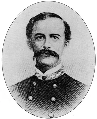
It’s also one of the few parks where you’ll cross a stretch of historic Route 66 inside the park boundaries.

Petrified Forest National Park
NPS/T Scott Williams

Saguaro National Park

  • Distance: 338 Miles
  • Drive Time: 5:25

If your Grand Canyon trip routes you through Phoenix, Saguaro National Park is an easy add that feels completely different from anything you’ve seen so far.

This is classic Sonoran Desert scenery. Towering saguaro cacti, some over 40 feet tall, dot the landscape like they were placed on purpose. The park is split into two districts around Tucson, but both are simple to access and easy to explore in a few hours.

A quick detour here gives your national parks road trip a totally different kind of Arizona. Our only advice? Avoid visiting during the hottest part of the summer, as temperatures can easily get into the triple digits with relentless sun.

Saguaro National Park
NPS Photo/ LNichols

Joshua Tree National Park

  • Distance: 365 Miles
  • Drive Time: 5:55

If your route swings through Southern California, Joshua Tree National Park is worth the detour. This is where two deserts collide, the Mojave and the Colorado, and the landscape shows off.

You get those quirky, spiky Joshua trees mixed with massive boulder piles that look like they were stacked by hand. It’s a favorite for photographers, climbers, and anyone who likes a slightly offbeat desert vibe. Stick around after sunset, and the night skies deliver, too.

Different, a little strange, and exactly the kind of stop that makes a national parks road trip feel layered instead of repetitive.

Joshua Tree National Park
NPS Photo/Brad Sutton

Lakes Near Grand Canyon National Park’s South Rim

The National Park Service also includes National Recreation Areas, and there are a couple close enough to Grand Canyon’s South Rim to take a trip.

Glen Canyon National Recreation Area

  • Distance: 139 Miles
  • Drive Time: 2:30

What makes Glen Canyon National Recreation Area worth the detour is the sheer contrast. This is where the Colorado River slows into Lake Powell, creating bright blue water against red rock cliffs.

You’ve got iconic stops like Horseshoe Bend and nearby slot canyons like Antelope Canyon, plus boating, kayaking, and beaches that feel wildly out of place in the desert. It’s less about hiking every mile and more about experiencing the landscape from the water, which is a completely different vibe from the Grand Canyon.

view of the Colorado River at Horseshoe Bend
Horseshoe Bend at Glen Canyon National Recreation Area

Lake Mead National Recreation Area

  • Distance: 251 Miles
  • Drive Time: 4:10

Lake Mead National Recreation Area is an easy add if your Grand Canyon trip includes Las Vegas. You’ll pass right through Hoover Dam, which is worth the drive alone, before dropping into the recreation area.

What makes Lake Mead National Recreation Area stand out is the scale. It’s the largest reservoir in the U.S., and it feels like an inland ocean surrounded by desert mountains. You can swim, boat, kayak, or just post up along the shoreline, which isn’t something you expect this close to the Mojave.

Kayaking on Lake Mead and the Colorado River at Lake Mead National Recreation Area
Lake Mead National Recreation Area | NPS Photo

National Forests Near the Grand Canyon’s South Rim

If you’re planning a Grand Canyon wedding, elopement, or special event, it’s worth mentioning the national forests nearby.

National parks are more like curated, protected showpieces with rules to match, while national forests are where you get a little more freedom to explore, camp, and roam without feeling like you’re on a set path.

If you’re interested in a Northern Arizona forest wedding, check out Flagstaff Forest Weddings.


Is Sedona Part of a National Park or National Forest?

Sedona isn’t part of a national park. It sits within Coconino National Forest. While national parks are free to access, there are recreation areas within the forests that might charge a fee. It also means more flexibility. You can hike, drive, or explore at your own pace without the same structured layout you’d expect inside a national park.

If you want something a bit more defined, Sedona also has a few state parks that are absolutely worth your time:

  • Red Rock State Park — smaller, quieter, and ideal if you want marked trails, education programs, and classic red rock views without the chaos of popular trailheads
  • Slide Rock State Park — a natural water slide through Oak Creek that’s perfect in warmer months and one of the most unique ways to cool off in the desert
  • Dead Horse Ranch State Park — just outside Sedona, with river access, birdwatching, and a more laid-back vibe if you want a break from the crowds

If you’re loving the idea of Sedona, visit our Sedona Wedding Packages website for ideas of how to celebrate a wedding, elopement, or special event there.

merry go round rock in sedona arizona
Merry Go Round Rock in Sedona, Arizona

Your Grand Canyon Wedding Adventure Starts Here

Planning a wedding here isn’t just about picking a viewpoint and hoping for the best. That’s where Grand Canyon Wedding Packages comes in. We’ve built relationships with trusted local vendors across Northern Arizona, so whether you’re planning something simple or going all out, we can match you with the right team, the right setting, and the right experience.

From timelines to photography, florals, and those small details that somehow become the big ones, we help bring your vision to life without the guesswork. And once the ceremony is set, we’ve got you covered with curated ideas for things to do across Northern Arizona, so your guests don’t just attend your wedding, they get a full-on adventure out of it.